

Explore the historic cities of Uzbekistan →
Uzbekistan • A history for travellers
The History of Uzbekistan
Uzbekistan's history connects ancient oasis settlements, Silk Road merchants, Islamic scholarship, powerful empires and the creation of a modern independent republic. Travelling through the country means moving between these layers: an archaeological mound near Termez, Bukhara's brick mausoleums, Samarkand's tiled monuments, Khiva's walled city and the twentieth-century avenues of Tashkent all reveal different chapters.
This guide follows the history of the lands within present-day Uzbekistan while recognising that earlier kingdoms, languages and trading networks crossed today's borders. Ancient Sogdiana, Bactria and Khorezm were not versions of the modern nation-state. Their shared Central Asian heritage nevertheless forms an essential part of the country's historical landscape.
Uzbekistan history at a glance
- First millennium BCE: Khorezm, Sogdiana and Bactria emerge as major historical regions; parts of Central Asia enter the Achaemenid Empire.
- 329–327 BCE: Alexander the Great campaigns in Sogdiana and Bactria, encountering sustained resistance.
- First centuries CE: Kushan power and Buddhist communities connect the south with Afghanistan and the Indian subcontinent.
- Sixth–eighth centuries: Turkic political power and Sogdian commercial networks shape Central Asia.
- Eighth century: Arab conquest establishes a new political framework; Islam spreads over subsequent generations.
- Ninth–tenth centuries: the Samanids make Bukhara a major centre of government and Persian literary culture.
- Eleventh–early thirteenth centuries: Turkic dynasties and the Khwarazmshahs reshape regional power.
- 1219–1221: the Mongol invasion devastates major centres across Central Asia.
- 1370–1405: Timur rules from Samarkand; his successors support influential artistic and scholarly traditions.
- Sixteenth–nineteenth centuries: Uzbek dynasties and the states of Bukhara, Khiva and Kokand shape the region.
- 1865–1876: Russian conquest brings Tashkent and the former Kokand Khanate under direct imperial rule; Bukhara and Khiva become protectorates.
- 1924: the Uzbek Soviet Socialist Republic is created during national-territorial delimitation.
- 1930: Tashkent replaces Samarkand as the republic's capital.
- 31 August 1991: Uzbekistan declares independence; 1 September becomes Independence Day.
- 2 March 1992: Uzbekistan joins the United Nations.
- From 2016–2017: a new political leadership begins a period of economic reform and greater international engagement.
1. Geography before borders: oases, rivers and routes
The Amu Darya, known in classical writing as the Oxus, and the Syr Darya helped define Central Asia's historical geography. The Zarafshan supported the oases of Samarkand and Bukhara, while the Fergana Valley formed another major zone of cultivation and settlement. Mountains, deserts and waterways influenced where people could live and how they travelled.
Irrigation made urban life possible, but a canal alone did not create a city. Communities needed to maintain water systems, organise agriculture and exchange goods. The histories of towns and countryside were therefore closely connected. Markets relied on surrounding producers, and cultivators needed the tools, services and institutions found in settlements.
Pastoral communities were also participants in this world. The relationship between steppe and oasis included commerce, political alliances and conflict. A history concerned only with decorated city buildings misses those connections. Even the country's most famous monuments were supported by resources and labour extending far beyond their walls.
The names Transoxiana and Mawarannahr both describe land beyond the Oxus, but from the perspective of those approaching from the south. Their use reminds us that historical geography depends on viewpoint. A river could serve as a political frontier in one period and an active corridor of exchange in another. Ferries, crossing places and neighbouring settlements made its banks part of a connected economy.
Distance also meant something different before railways and motor roads. A short route across difficult terrain might require more effort than a longer journey through reliable stopping places. Regional importance depended on connections that a modern road map can conceal. This is one reason why an apparently remote archaeological site may once have occupied a valuable position.
2. Before the great empires
Archaeology reveals human occupation long before the emergence of the states described in written sources. Stone tools, burial sites and traces of settlement provide evidence for communities whose names have not survived. Later agricultural settlements show how food production, specialised work and more complex social organisation developed over time.
In southern Uzbekistan, Bronze Age sites such as Sapallitepa and Jarkutan belong to this earlier history of settled life. Their importance lies in the evidence of buildings, production and community organisation, rather than in a connection with the later blue-tiled monuments familiar from travel photographs. They represent a different historical landscape.
The State Museum of the History of Uzbekistan in Tashkent offers a useful introduction to the long sequence. Museum objects help connect changes in technology and daily life with the larger political story. Keep a distinction between an excavated object, a reconstruction and an artist's interpretation: each communicates the past in a different way.
The development of agriculture did not immediately eliminate other ways of living. Farming, herding and the seasonal use of different environments could coexist. Excavated animal bones, plant remains and tools help researchers investigate that mixture. Changes in storage or production may reveal shifts in how households organised resources without telling us the personal names of those involved.
Archaeological periods should therefore be treated as frameworks for interpreting evidence, not as dates on which every community changed its way of life. New techniques spread unevenly. A useful museum visit follows those variations: compare the materials used, the work required to make an object and the purpose it served. This brings the long prehistory into focus before written chronicles become available.
3. Sogdiana, Bactria and Khorezm
Three names recur in accounts of ancient Central Asia. Sogdiana was centred on the Zarafshan and Kashkadarya regions, including Samarkand. Bactria extended across the upper Amu Darya world, embracing lands in modern Afghanistan, Tajikistan and southern Uzbekistan. Khorezm developed around the lower Amu Darya, with a history distinct from the southern oases.
These regions were not consistently united under one authority. They had their own settlements, political relationships and cultural traditions. Their boundaries and influence changed, making it misleading to draw them as permanent blocks matching contemporary national borders. A map for one century cannot automatically explain another.
For travellers, the distinction provides a useful framework. The ancient site of Afrosiab opens the Sogdian history of Samarkand; the archaeological landscape around Termez introduces northern Bactria and later Buddhist communities; the fortresses of the lower Amu Darya reveal another regional tradition. See the State History Museum's ancient-history overview.
Khorezm's fortified sites illustrate particularly well why regional histories deserve separate attention. Earthen walls and palatial remains in the lower Amu Darya landscape reflect settlement systems different from the familiar streets of Bukhara. Some sites are now surrounded by arid ground, making it difficult to imagine their former relationship with cultivated land. Their setting has changed as well as their architecture.
In the east, Fergana had its own connections with the steppe and China. Accounts of the valley's horses belong to the history of political and commercial contact across Asia. The valley was not merely a passage between supposedly more important places. Its resources and settlements helped shape the routes through which others approached Central Asia.
Reading the desert fortresses of Khorezm
The ruined fortresses of the lower Amu Darya introduce an architectural language quite different from the glazed monuments of Samarkand. Toprak Qala preserves the remains of a planned settlement and an elevated palace complex. Excavations revealed decorated rooms, sculpture and written records, connecting royal display with administration. Ayaz Qala refers to a group of sites with different layouts and phases, rather than one building constructed in a single campaign. Koy-Kirilgan Qala is notable for its circular plan. These contrasts appear in Uzbekistan's Desert Castles of Ancient Khorezm submission to UNESCO's Tentative List.
The word qala, also written kala, broadly signals a fortified place. It does not tell us whether the remains belonged principally to a palace, a settlement, a refuge or a defensive installation. An enclosure with extensive domestic accommodation raises different questions from a large courtyard with comparatively little internal construction. Comparing plans helps restore these differences, which can disappear when every site is described simply as an ancient castle.
Earth was a sophisticated building material, not merely a substitute used before people discovered stone. Builders could create thick walls, elevated platforms and substantial vaulted spaces using earthen construction. Its survival depends heavily on exposure and maintenance. A rounded wall visible today may preserve the core of a much more sharply articulated structure whose protective surfaces have disappeared. The ruin's present texture should not be mistaken for its original finish.
These sites also change the scale on which we imagine the past. Standing on a palace platform encourages a view across the wider landscape: where might fields, water channels and approaches have been? Archaeological plans and environmental evidence are needed to answer precisely, but even posing the question moves the story beyond kings and sieges. A fortified centre required supplies, labour and connections with people living outside its walls. The empty-looking surroundings belong to the historical problem as much as the monument itself.
Fergana before the rise of Kokand
Fergana's history begins long before its eighteenth-century khanate. Archaeological research identifies settled farming communities associated with the Chust culture, alongside pastoral ways of life in neighbouring environments. Objects arriving from China provide another line of evidence for eastern connections. Written accounts traditionally associated with ancient Dayuan add to the picture, although the identification of places and political territories in early sources is not always straightforward. Boris Marshak's study of pre-Islamic Fergana explains both the evidence and some of these uncertainties.
By the early Islamic period, Aksikath was an important political centre. Medieval geographers described a productive valley with towns, agricultural land and mineral resources, including materials supporting metalworking. Later, Andijan rose in prominence. This was a changing urban network, not a valley permanently organised around its most famous modern cities. The account of Islamic-period Fergana gives the longer chronology behind that shift.
For understanding the region, it helps to separate three things: the age of a settlement, the period when it became a capital, and the date of the monuments that remain visible. An ancient place may preserve mostly recent buildings. A comparatively young political capital may stand within a landscape cultivated for many centuries. Neither situation makes the history less important; it changes the kinds of evidence needed to investigate it.
The valley also challenges an exclusively westward view of Central Asia. Its history looks towards mountain passes, neighbouring steppe communities and markets farther east, as well as towards Samarkand and Bukhara. On a map, the surrounding mountains can appear to seal it off. Historically, passes created selective connections through which people, animals and goods could move. The productive land within the valley and the routes out of it need to be considered together. This broader setting explains why Fergana repeatedly attracted political ambition while sustaining several distinct urban centres.
4. Achaemenid rule and Alexander's campaigns
During the first millennium BCE, parts of Central Asia became incorporated into the Achaemenid Persian Empire. Imperial connections brought the region into a political world reaching far beyond its oases. Local societies retained distinctive features while participating in larger systems of power, tribute and movement.
Alexander's campaigns in the late fourth century BCE followed his defeat of the Achaemenid monarchy. His advance into Bactria and Sogdiana encountered resistance, associated particularly with Spitamenes. The conquest was a prolonged struggle involving fortifications, local alliances and military operations; it was not a peaceful transfer of ownership between two famous rulers.
Greek influence subsequently interacted with regional traditions under Alexander's successors and the Greco-Bactrian kingdom. Coinage and artistic forms can show such encounters, but the label 'Greek' should not erase local participation. Visitors should also distinguish documented campaigns from later legends that attribute almost any old fortress or water source to Alexander.
Imperial rule depended on negotiation with local elites as well as the presence of troops. Rulers needed people who understood settlements, resources and existing relationships. Resistance likewise involved more than a single battle: alliances could shift, leaders could retreat and communities could respond differently to an advancing army. The experience of conquest varied across the region.
After Alexander, the continued appearance of Greek inscriptions or imagery on coins did not mean that the population had become culturally uniform. Coins made claims about authority and could circulate among people with different languages. Their images are evidence of how rulers wished to be recognised, while everyday objects and settlement remains can reveal other aspects of society.
5. The Kushans and the Buddhist south
In the first centuries CE, the Kushan Empire linked territories across parts of Central Asia, Afghanistan and the Indian subcontinent. The south of present-day Uzbekistan belonged to a world of movement across the Amu Darya, rather than to an isolated northern edge. Religious ideas, goods and artistic practices travelled along these connections.
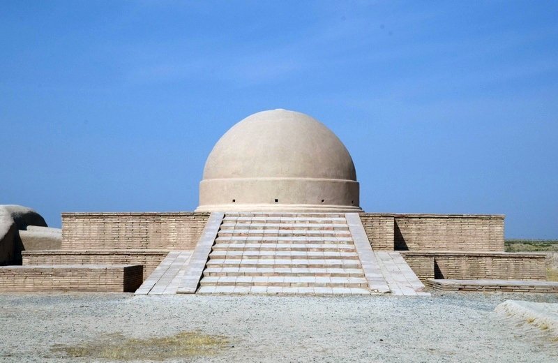
The Buddhist sites around Termez make this chapter particularly tangible. Fayaztepa and Karatepa preserve evidence of monastic communities and devotional activity. Their significance helps explain why a country now strongly associated with Islamic architecture also contains an important Buddhist archaeological heritage.
Look at these remains alongside objects in archaeological collections. Sculpture, architectural fragments and inscriptions can reveal connections that the surviving ground plan alone does not make obvious. Modern protective structures should be distinguished from ancient fabric. Continue with the history of Termez and the Met's introduction to Buddhism along the Silk Road.
Buddhist communities needed material support. Buildings, food supplies, objects of devotion and the copying or transmission of teachings all required resources. Monasteries were connected to patrons and nearby settlements rather than existing outside economic life. Looking at the scale and layout of a monastic site encourages questions about the people who maintained it, not only the sculptures once displayed there.
The movement of Buddhism was also a history of translation. Teachings crossed linguistic boundaries through the work of travellers and scholars. The artistic forms associated with Buddhist practice changed as they encountered different audiences. Termez's importance is best understood within these overlapping religious, commercial and intellectual connections, which linked Central Asia with regions far to its south and east.
6. The Silk Roads and the Sogdian world
The Silk Roads were a network of changing routes, not one continuous road operated by a single empire. Many merchants travelled only part of the distance between producers and consumers. Trade depended on local markets, political conditions and the practical availability of water, animals and secure stopping places.
Sogdian merchants and communities became influential intermediaries across this network. Their importance extended beyond transporting silk: languages, religious traditions and forms of representation moved through the same relationships. The cultural variety of Central Asia was produced through repeated contact as well as local development.
Written records can bring this world closer than general descriptions of caravans. The Mount Mugh documents, discovered in present-day Tajikistan, include correspondence, contracts and administrative material from the early eighth century. They illuminate a shared Sogdian setting across modern borders. UNESCO's description of the collection explains its value for understanding everyday life and the transition to Islamic rule.
Luxury goods attract attention because they survive in impressive collections, but routes also depended on ordinary supplies. Caravans required food, fodder, repair and local information. A settlement could benefit from servicing movement even when few residents travelled far. The commercial landscape was sustained by innkeepers, animal handlers, producers and small traders as well as wealthy long-distance merchants.
Nor did exchange mean uninterrupted peace. Toll demands, insecurity and political conflict could redirect traffic. Merchants adapted by using trusted partners and local intermediaries. The Silk Roads are therefore better understood as a set of changing relationships than as a permanent golden age. Their history includes opportunity and vulnerability, and the ability of communities to respond to both.
Caravan infrastructure: water, shelter and the cost of movement
Rabati Malik, on the route between the Samarkand and Bukhara regions, makes the infrastructure of travel visible. The monumental complex belongs to the Qarakhanid period, with construction associated with Shams al-Mulk in the eleventh century. Its surviving entrance and the nearby sardoba, a covered water reservoir, allow architecture and water provision to be considered together. The World Heritage account of Rabati Malik and its sardoba provides a useful introduction to the site.
A caravanserai should not be imagined as a modern hotel placed beside a picturesque route. Travel involved animals, bulky loads and groups whose requirements differed from those of a passenger arriving with a suitcase. Entry, storage, accommodation and access to supplies were practical problems. The organisation of a stopping place tells us something about how journeys were broken into stages and how people managed valuable goods in unfamiliar surroundings.
Water imposed its own geography. The significance of a reservoir was not confined to the volume it held. Dependable water made a route usable and could influence where travellers stopped, how many animals they brought and how much they needed to carry. Maintenance mattered as much as initial construction. A damaged supply system could alter the practical value of a road even when its physical course remained open.
Travel also created work for communities along the way. Animals needed handling and feeding; equipment required repairs; merchants sought information about conditions ahead. Those services connect large-scale exchange with local livelihoods. A map of long-distance routes becomes more meaningful when it includes the people who enabled movement without necessarily undertaking long journeys themselves.
This helps explain why the history of the Silk Roads should include ordinary material constraints alongside diplomatic missions and luxury goods. The impressive entrance of Rabati Malik expresses the resources of a patron. The reservoir beside it reveals a different requirement: without reliable water, architectural ambition alone could not sustain movement through the landscape.
7. Turkic power and the arrival of Islam
Before the Arab conquest, Central Asia experienced successive political formations, including Hephthalite and Turkic power. The rise of Turkic states did not instantly replace every local language or institution. Sogdian communities continued to play important roles within wider political networks, and cultural change unfolded unevenly.
Arab campaigns in the early eighth century established a new framework of rule. Samarkand was taken by Qutayba ibn Muslim in 712, but conquest and conversion should not be treated as the same event. The spread of Islam involved generations of religious teaching, institutional development and changes in social relationships.
Earlier religious traditions were varied, including local cults, forms associated with Zoroastrianism and Buddhist communities in the south. The resulting transformation was more complex than replacing one uniform faith with another. UNESCO's study of Sogdian cults provides context for that diversity; Samarkand's UNESCO record situates the city within these successive periods.
The establishment of mosques and religious teaching changed the organisation of urban space. New institutions acquired public importance, while older social relationships did not simply disappear. Political loyalty, participation in religious life and the use of particular languages could develop at different speeds. A chronicle's account of a conquest rarely captures the whole process.
The distinction matters when interpreting monuments associated with early Islamic figures. Many memorial complexes visible today were constructed or substantially renewed long after the lives of the people they honour. Their religious significance may be old even where the architecture is recent. They document the continued importance of memory and pilgrimage, alongside the original biography of a teacher or scholar.
8. Bukhara and the Samanid period
During the ninth and tenth centuries, the Samanids established a powerful regional state, with Bukhara as a major centre. Their court is associated with the development of New Persian literary culture, while Arabic retained a central place in scholarship and religious learning. Several languages and intellectual traditions could flourish within the same society.
The Samanid Mausoleum in Bukhara offers an unusually direct architectural encounter with this period. Its patterned brickwork demonstrates how structure, surface and light could create a rich visual effect without the extensive glazed tile revetment associated with later monuments. It is a useful starting point for learning to distinguish architectural eras.
The wider material culture also matters. Ceramics, metalwork and manuscripts give evidence of cultivated urban environments beyond the royal court. The Met's historical introduction to Islamic art discusses the Samanid context. For the city's longer story, read the history of Bukhara.
The intellectual reputation of Bukhara depended on institutions and audiences. A court could support poets and scholars, but urban learning also required teachers, students, books and people able to supply their needs. The production of written knowledge was an organised activity, connected with skills such as paper-making, calligraphy and binding as well as authorship.
This helps explain why political and cultural chronologies do not always coincide. A dynasty may fall while literary practices and scholarly networks continue. Conversely, a ruler's patronage can redirect resources towards a particular city without creating all its traditions from nothing. The Samanid period was influential because of the cultural relationships it strengthened, not simply because one family held power.
9. Scholars, languages and the movement of knowledge
The region's intellectual heritage includes figures whose work travelled far beyond their places of origin. Al-Khwarizmi is associated with mathematics and the scholarly world of Baghdad; al-Biruni wrote across fields including astronomy and geography; Ibn Sina, born near Bukhara, became influential in medicine and philosophy. Their careers crossed political and cultural boundaries.
This is a shared history rather than a competition to fit every scholar into a modern nationality. Places of birth, languages of writing, patrons and destinations of travel all contribute to a biography. A person could be connected with today's Uzbekistan while spending decisive years elsewhere and writing for readers across a much larger world.
Religious scholarship and Sufi teaching also connected towns and smaller settlements. The histories of Bukhara, Termez and Gijduvan show different aspects of these networks. A memorial's present architecture may be much younger than the person honoured there, so separate the scholar's lifetime from the construction and restoration of the complex visited today.
Scientific work often addressed practical questions. Astronomical observation supported calendars and the measurement of time; mathematical methods helped organise calculation; medicine required the classification and discussion of symptoms and treatments. Those activities could also lead scholars towards theoretical problems extending far beyond immediate needs. Practical and intellectual interests were not separate worlds.
Translation and criticism were essential. Scholars engaged with earlier Greek, Indian and other traditions, but their work was not merely the preservation of inherited books. They compared methods, revised arguments and produced new knowledge. When a museum celebrates an individual, it is useful to ask who taught that person, which texts were available and how later readers used the work.
What al-Khwarizmi changed in mathematics
Al-Khwarizmi's importance becomes clearer when his work is described more precisely than the familiar label 'father of algebra'. Working in the Abbasid scholarly environment of Baghdad in the ninth century, he presented systematic methods for solving classes of equations. His explanations used words and geometrical reasoning rather than modern algebraic notation. His work also addressed practical calculations, including problems arising from commerce and inheritance. The University of St Andrews' MacTutor biography explains the mathematics and the limits of what is known about his life.
The modern words algebra and algorithm preserve different parts of this legacy: the former developed from the title of his algebraic treatise, the latter through Latin forms of his name. These linguistic traces are striking, but they should not become a claim that one person invented every aspect of modern calculation. Mathematical traditions had long histories before him, and later authors transformed the methods they received. His achievement lies in a particular body of work and its influence.
Consider the difference between solving one numerical puzzle and explaining a method that applies to a whole category of problems. The second approach allows knowledge to travel beyond the original example. A reader can learn a procedure, recognise a related situation and apply the reasoning again. That distinction helps a nonspecialist understand why a treatise could remain useful across languages and generations.
The history of transmission matters just as much as the initial writing. A mathematical work needs readers who can interpret its terms, teachers who can explain difficult passages, and copyists or translators who make it available elsewhere. Errors can enter that chain, but so can clarification and new developments. A celebrated author's surviving influence is therefore also evidence of the work of many less famous people.
For Uzbekistan's history, al-Khwarizmi illustrates how a regional connection can open onto a much wider intellectual geography. Khorezm, Baghdad and later centres of translation belong to the same story without being interchangeable places. The strongest account follows those connections instead of trying to contain the whole achievement within one modern national boundary.
Al-Biruni and Ibn Sina: two paths through a connected scholarly world
Al-Biruni, born in Khorezm in 973, worked across astronomy, mathematical geography and the study of other societies. His career was disrupted by political change, and his later life became closely connected with Ghazni and the Indian subcontinent. His study of India engaged with languages, religious ideas, calendars and scientific traditions. This combination of comparison and observation makes him more interesting than a list of modern disciplines attached to his name. The St Andrews biography of al-Biruni follows his changing locations and research.
One particularly revealing example is his interest in measuring geographical position. Observations of the sky could help establish latitude, while comparing an astronomical event observed in different places could contribute to determining differences in longitude. Such work linked an apparently remote celestial phenomenon with the practical problem of locating places on Earth. Geography and astronomy were parts of a shared mathematical investigation.
Ibn Sina, known in Latin as Avicenna, was born near Bukhara around 980. His career also crossed several courts and regions. The Canon of Medicine became an influential synthesis of medical knowledge, while his philosophical writings extended into logic and questions about the nature of existence and knowledge. The St Andrews account of Ibn Sina situates these achievements within a mobile and politically complicated life.
Their biographies show that scholarly careers did not unfold in protected spaces entirely separate from government. Access to books, employment and patronage could make research possible; a political reversal could force movement or interrupt work. A court might attract several exceptional individuals without guaranteeing their security. The same networks that enabled intellectual exchange could expose scholars to the ambitions and conflicts of their patrons.
The comparison also guards against reducing the period to a single kind of achievement. Al-Biruni's investigations and Ibn Sina's influential syntheses illuminate different intellectual approaches. Neither fits neatly into one modern university department. Their subjects overlapped, but their questions, methods and surviving reputations were not identical.
Encountering their names in museums, monuments and street signs is therefore only a beginning. The richer historical question is what they actually investigated, which earlier knowledge they used, and why later readers found their work valuable. Those questions connect public commemoration with intellectual history. They also make clear why Uzbekistan's scholarly heritage belongs within a wider story of Central Asian, Iranian, Arabic-language and Indian traditions interacting across political boundaries.
10. Turkic dynasties and the Khwarazmshahs
The end of Samanid rule around the close of the tenth century opened a new political chapter. Qarakhanid rulers established authority in Transoxiana, while neighbouring powers competed over other former Samanid territories. Turkic political leadership and Persianate urban culture interacted rather than forming neatly separated worlds.
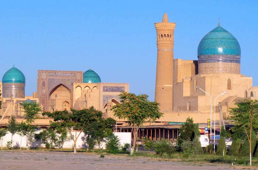
The Qarakhanid era contributed significant buildings to the region. Bukhara's Kalyan Minaret, completed in 1127, is one of its best-known survivors. Its presence inside an ensemble substantially shaped by later centuries demonstrates why a monument group should not be assigned a single date merely because its buildings stand together.
By the early thirteenth century, the Khwarazmshahs ruled a large empire. Its reach far exceeded modern Uzbekistan, and its political history must be distinguished from that of the later Khiva Khanate. Similar regional names can refer to states separated by centuries. The Mongol invasion brought a violent end to this phase of imperial expansion.
Political authority was also expressed through public building. A minaret or madrasah could demonstrate a ruler's resources and religious commitments, while benefiting the city's institutions. Inscriptions made patronage visible. Monumental architecture should therefore be read as an intervention in public life, rather than only as a development in decorative style.
The survival of a building can distort our sense of a period. One exceptionally durable minaret may become its symbol, while houses, workshops and smaller religious spaces have disappeared. A fuller picture combines standing architecture with excavation and museum collections. The ordinary objects of the Qarakhanid and later periods can show how people inhabited the world represented so dramatically by royal commissions.
11. The Mongol invasion and the Chagatai world
The Mongol campaigns of 1219–1221 caused enormous destruction across Central Asia. Bukhara and Samarkand were among the major centres affected. Death, displacement and damage to settlements altered the region's political and economic life. The impact should not be softened into a simple change of dynasty.
Recovery nevertheless followed different paths in different places. Communities rebuilt, urban centres shifted and trade resumed under new conditions. In Samarkand, the relationship between the abandoned ancient site of Afrosiab and later urban development makes this transition especially visible. The city encountered by a visitor today is not simply the ancient settlement with newer façades.
Much of Transoxiana became part of the Chagatai political sphere, named after a son of Chinggis Khan. Over time, Mongol and Turkic traditions, local institutions and Islamic culture interacted. This changing environment formed the background to Timur's rise in the fourteenth century. The period between invasion and Timurid rule was a historical chapter in its own right.
The consequences of the Mongol invasion were uneven and extended beyond the immediate destruction. The movement of people, changes in agricultural infrastructure and the redirection of authority affected how recovery could occur. Rebuilding a wall was only one part of restoring a functioning town. Markets and institutions also depended on the return or reorganisation of communities.
Later Mongol imperial connections created opportunities for movement across large distances, but these should not be used to minimise the violence of conquest. Different generations experienced different conditions. A historical account needs to hold both phases in view: the devastating initial campaigns and the political, commercial and cultural arrangements that emerged afterwards. Neither is an adequate substitute for the other.
12. Timur and the remaking of Samarkand
In 1370, Timur established his supremacy in Transoxiana and made Samarkand his capital. His campaigns built an empire extending across a large part of western and Central Asia. The wealth and skills concentrated in the capital transformed its monumental landscape and gave it a prominent place in the history of architecture.
That achievement cannot be separated from conquest. Timur's armies caused extensive destruction, and skilled people were among those forcibly transferred from conquered territories. The buildings associated with his rule represent artistic accomplishment as well as the power and human costs of an imperial project.
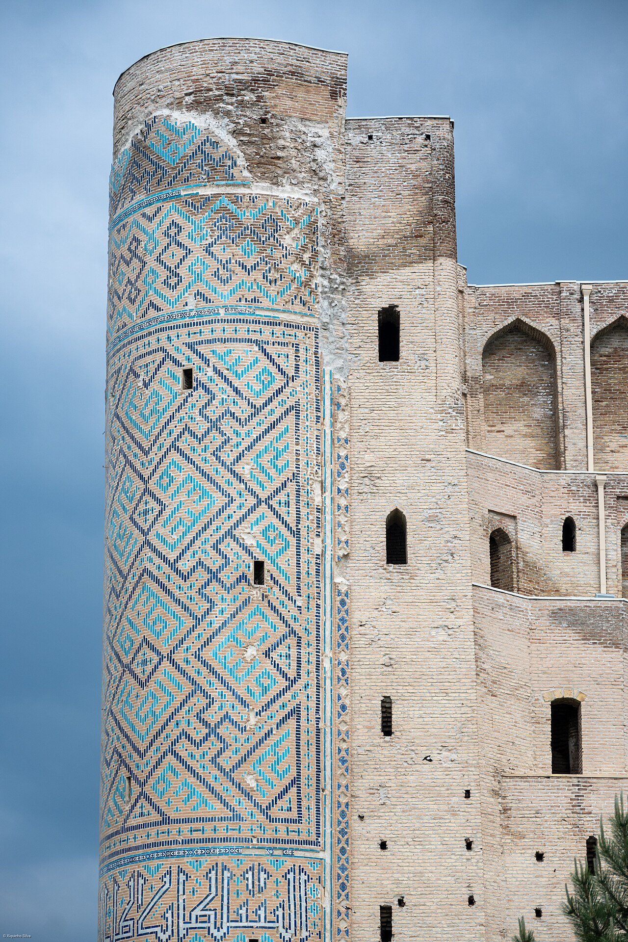
Samarkand and Shakhrisabz offer complementary views. Samarkand shows the capital's ceremonial ambitions, while the remains of Ak-Saray at Shakhrisabz convey the scale of palace patronage. Read the history of Samarkand and the history of Shakhrisabz. The Met's Timurid art overview explains the dynasty's wider cultural setting.
Timur's position also depended on the political traditions inherited from the Chagatai world. Military success alone did not remove the need to justify authority. Titles, marriage connections and the use of established forms of rule all contributed to how power was presented. The court was a place where political legitimacy was performed as well as administered.
Architecture extended that performance into the city. Large entrances, carefully organised approaches and richly finished surfaces shaped the experience of ambassadors, residents and visitors. A building's scale communicated hierarchy before anyone read an inscription. In Samarkand and Shakhrisabz, the relationship between ceremonial space and the surrounding town is therefore as important as the individual tile patterns preserved on a façade.
13. Ulugh Beg, Timurid culture and Babur
After Timur's death in 1405, his successors maintained centres of patronage while competing for power. Herat, in present-day Afghanistan, became especially important. The Timurid cultural world crossed modern national frontiers and connected workshops, libraries, scholars and courts across a broad region.
In Samarkand, Ulugh Beg's astronomical activity and madrasah patronage represent a distinctive part of that inheritance. His observatory was a place of collaborative scientific work, not simply a monument to one isolated genius. The surviving archaeological remains help visitors connect observation, calculation and royal support for learning.
Babur belonged to the Timurid dynasty and was born in Andijan in 1483. After struggles in Central Asia and the establishment of a base in Kabul, his victory at Panipat in 1526 began Mughal rule in northern India. His career is a reminder that Uzbekistan's historical connections also lead southward. Andijan's history provides the valley context for his early life.
The Timurid world also gave lasting prominence to literary expression in Chagatai Turkic alongside Persian. Alisher Navoi, whose career was centred on Herat, became a foundational figure for the later Uzbek literary tradition. His importance should not be confused with a claim that Herat lay within modern Uzbekistan. Cultural inheritance follows languages, readerships and historical connections as well as political boundaries.
Babur's memoirs provide another kind of evidence. They record a ruler's observations and personal interests alongside political events, allowing readers to encounter places through an individual voice. Such accounts are valuable precisely because they have a viewpoint. They should be read as authored works, with preferences and limitations, rather than as neutral records of everything that happened.
Inside the intellectual world of Ulugh Beg's observatory
Ulugh Beg's Samarkand school included scholars such as Qadi Zada, Jamshid al-Kashi and Ali Qushji. Al-Kashi's surviving letters offer a rare glimpse of mathematical discussion and the personalities involved. The observatory's large instruments supported observations that fed into astronomical tables and a star catalogue. These were collective undertakings requiring mathematical skill as well as a ruler's patronage. The MacTutor account of Ulugh Beg introduces the people and the work.
Before telescopes, measuring the sky depended on carefully designed instruments, sighting and calculation. A large scale could make small angular differences easier to distinguish, but size alone did not guarantee accuracy. Alignment, repeated observation and the interpretation of results remained essential. The surviving arc at the observatory is consequently more than an impressive fragment: it points towards a method of making measurements.
An astronomical table was a working tool. Instead of narrating the appearance of the heavens, it organised numerical information that others could consult and use. Such a work connected observation with calendars and mathematical models. Its value depended partly on whether later users could understand its conventions and adapt calculations to their own purposes. The movement of tables and manuscripts extended the life of a scientific centre beyond its buildings.
This also explains why the end of a court's patronage did not necessarily end an intellectual tradition. People could move, texts could be copied, and methods could be taught elsewhere. Political disruption might destroy an institution while leaving parts of its knowledge in circulation. The history of an observatory therefore has at least two timelines: the operation of the physical establishment and the later reception of the work produced there.
For a visitor, the madrasah at the Registan and the observatory site offer complementary perspectives. One evokes an institution of learning within the city, while the other reveals the specialised physical requirements of observation. Read together, they make scientific history more concrete than a list of famous discoveries. They connect teaching, instruments, calculation and government support within the same urban world.
14. Uzbek dynasties and the khanates
In the early sixteenth century, Muhammad Shaybani and his followers displaced Timurid rule in much of Transoxiana. The political prominence of Uzbek dynasties forms an important chapter in the region's history, but the development of Uzbek identity was a longer process involving earlier populations, migrations and cultural interaction.
Over the following centuries, Bukhara, Khiva and Kokand became the best-known regional states. They were not three provinces of a single country with today's borders. Their territories, relationships and institutions changed, and their histories involved both rivalry and exchange. Irrigation, taxation, religious patronage and craft production were central to their economies.
Many buildings that visitors call 'Silk Road monuments' belong to these later centuries. Khiva's walled city and Kokand's palace are particularly helpful reminders that regional urban history continued well beyond the medieval caravan era. Compare Khiva and Kokand, with UNESCO's Itchan Kala record and the scholarly Kokand Khanate history.
Bukhara, Khiva and Kokand developed different political centres and architectural environments. Bukhara's institutions connected rulership with religious learning and commerce. Khiva's inner city concentrated courtly and religious buildings within a compact enclosure. Kokand's expansion was closely tied to the changing economic and demographic life of the Fergana Valley. These contrasts are more useful than treating the three states as identical rivals.
The nineteenth century brought new construction as well as conflict. Irrigation schemes and planned settlements continued to reshape the valley. Shahrihan's foundation under Umar Khan is one example of a town emerging through water management and the movement of skilled people. It demonstrates that the urban history of Uzbekistan was still developing long after the eras most often associated with the Silk Roads.
Bukhara: dynasty, religious authority and the urban economy
The transition from Shaybanid to later Janid, or Ashtarkhanid, rule did not erase Bukhara's importance. In the eighteenth century, the Manghits established a new ruling dynasty. Muhammad Rahim's rise was connected with the political upheavals surrounding Nader Shah's intervention in Central Asia. Manghit rulers used different combinations of genealogy, military power and religious authority to justify their position. The scholarly history of the Manghits shows why their emergence cannot be reduced to a simple change of royal surname.
Bukhara's buildings provide another chronology. The city contains early monuments, but much of the familiar ensemble reflects construction and rebuilding from the sixteenth century onwards. Trading domes, madrasahs and the Lyabi-Hauz area show how commercial, educational and public spaces were brought into close relationship. UNESCO's Historic Centre of Bukhara record stresses the significance of the overall urban fabric, not only its individual masterpieces.
Religious and economic life were closely connected. A teaching institution needed continuing income, staff and supplies; a neighbourhood required shops and services; a government depended on revenue. These relationships help explain why monuments are rarely self-contained historical objects. Their construction was one event, but their continued operation involved many decisions about resources and responsibility. The person named on an inscription may have initiated a building without being the only figure responsible for its later life.
The term emirate can also mislead if it suggests a state with the same reach and administrative uniformity as a modern government. Authority had to be exercised through officials and negotiated relationships across settlements and regions. Control at the centre did not automatically produce identical conditions everywhere. A capital's ceremonial spaces show how a ruler wished authority to appear; documents and regional histories help reveal how it actually worked.
Seen this way, Bukhara offers more than a succession of beautiful façades. The proximity of a market, a school and a gathering place invites a connected reading of the city. People moved between these spaces to trade, study, worship and conduct business, making the built environment part of their daily negotiation of social and political life.
Khiva: a court in the irrigated landscape of Khorezm
Khiva's rise to prominence belongs especially to the early modern history of Khorezm. It became the capital under Arab Muhammad Khan in the early seventeenth century, while Urgench retained an important commercial role. In the nineteenth century, Qonghrat rulers commissioned much of the architecture that gives the inner city its distinctive appearance. These changes are traced in the scholarly history of Khiva.
The same study describes an economy in which irrigation, taxation and relations with different population groups were fundamental. It also documents slavery, including captives brought from Iran and the Russian frontier. The beauty of courtly buildings should not conceal the coercion present in the society that produced them. After the Russian conquest in 1873, the khanate continued under restricted sovereignty; this arrangement differed from direct annexation.
Itchan Kala makes royal and religious patronage unusually easy to compare because so many buildings occupy a compact area. A palace, a madrasah and a shrine served different purposes, even when they employed related decorative techniques. Looking at entrances and internal arrangements helps separate ceremonial display, teaching, worship and accommodation. The UNESCO description of Itchan Kala provides the architectural framework for this comparison.
The walls also create a powerful visual impression that needs interpretation. A bounded historic centre can look like a complete society, but the city depended on resources and labour far beyond the enclosure. Food, building materials and water connected it with a much larger territory. Khiva's history is therefore inseparable from the lower Amu Darya and the communities whose work sustained the capital.
A useful way to read the city is to move mentally between three scales: a room and its decoration, the institution containing it, and the landscape supporting that institution. Each scale reveals something the others can hide. Decoration brings craftsmanship into focus; the building plan suggests use and hierarchy; the wider setting raises questions about income, production and power. Together they produce a richer historical picture than treating the walled city as a single preserved moment.
Kokand and a valley connected to the wider world
Kokand developed as an independent centre during the eighteenth century under rulers from the Ming lineage. Its expansion eventually carried political influence far beyond the Fergana Valley into territories now divided between several countries. Migration and agricultural development helped the state grow. The Kokand Khanate study places that growth within Central Asian and eastern commercial connections rather than describing an isolated state awaiting European arrival.
This eastern dimension is especially useful. A traveller approaching Uzbekistan through Tashkent, Samarkand and Bukhara may encounter the valley only as an optional extension. Historically, the valley had its own routes and centres of power. Its relationships with neighbouring mountain and steppe societies mattered politically and economically. The geography of a modern holiday itinerary should not become the geography of the historical explanation.
Kokand's palace gives royal authority a visible centre, but a palace cannot explain an entire state. Agricultural production, settlement growth and relationships between urban and pastoral groups supplied the wider context. The same expansion that enriched a court could create competing demands over taxation, labour and resources. Monumental splendour and political instability could coexist; they are not contradictory descriptions of the period.
The contrast with Bukhara and Khiva is instructive. These states shared some political vocabulary and cultural practices, yet occupied different ecological and commercial settings. Khiva looked across the lower Amu Darya world; Bukhara drew on the institutions of a major oasis capital; Kokand developed within the densely connected valley and its surrounding routes. Their histories are most revealing when comparison preserves these differences.
The disappearance of the khanate in 1876 did not mean that the valley's communities or economic relationships began again from nothing. A new administration inherited an inhabited landscape. Older skills, local connections and memories continued within altered institutions. The nineteenth-century transition is therefore best studied through both political rupture and social continuity: who now governed, which relationships changed, and which forms of everyday knowledge remained indispensable.
15. Russian conquest and colonial administration
Russian expansion transformed Central Asia during the nineteenth century. Tashkent was captured in 1865 and became an imperial administrative centre. Bukhara was subordinated as a protectorate following the campaigns of 1868; Khiva followed in 1873. The Kokand Khanate was abolished in 1876, and its territory was incorporated into Russian administration.
Directly governed territory and protectorates should be distinguished. The continued existence of an emir or khan did not mean unrestricted independence, but the administrative arrangements differed from those in Tashkent or the Fergana Valley. These differences help explain the region's uneven transition into the twentieth century.
Railways, new urban districts and expanding cotton production altered economic relationships. Colonial development brought infrastructure alongside unequal political power and new pressures on land and labour. Tashkent's urban history makes the coexistence of older neighbourhoods and imperial planning especially visible. See the history of Tashkent for a closer account of that transformation.
Imperial urban development often created a contrast between an older settlement and a newer administrative district. The latter could have wider streets and buildings serving colonial institutions. The contrast was not merely visual: it reflected unequal access to decision-making and different arrangements of power. Present-day streets can preserve traces of that division even after their uses have changed.
Rail transport altered the scale of exchange by linking agricultural production more closely with distant industrial demand. Cotton's growing importance made the region increasingly sensitive to policies and markets outside local communities. Economic connections could create opportunities for some while increasing dependence for others. The effects of colonial integration therefore need to be examined through households and labour as well as infrastructure.
Photography and the colonial image of Turkestan
The Turkestan Album of 1871–1872 offers an extraordinary visual record of buildings, occupations and people during the early decades of Russian rule. The Library of Congress provides online access to the album, while the UNESCO regional documentary-heritage record describes the copy preserved in Uzbekistan. Photographs and drawings allow details to be examined that are difficult to recover from modern streets alone.
These images require the same care as written colonial sources. A photographer chose a subject, a viewpoint and a moment. An album's editors selected images and arranged them into categories. Those decisions could present a population as a series of fixed social types or turn conquest into a story of imperial achievement. The camera recorded real details, but the finished publication was still an authored representation.
For architectural history, comparison can be particularly productive. An early photograph may show a building before later repair, reveal a missing element, or preserve neighbouring structures subsequently demolished. It cannot automatically tell us which parts were original at the moment of photography. Nineteenth-century buildings had already experienced centuries of rebuilding, and an old image may record one intermediate state rather than a pure original.
The same caution applies to photographs of work. Tools, clothing and the arrangement of a workshop provide evidence, but a posed scene may not show the ordinary pace or organisation of labour. A caption can identify an occupation while overlooking the participation of family members, apprentices or suppliers. Reading the photograph closely means attending to both what appears inside the frame and the activities the frame cannot explain.
These albums are valuable because they make historical questions more precise. Instead of asking vaguely whether a monument has changed, it becomes possible to compare a doorway, roofline or street edge. Instead of treating a craft as timeless, a dated image provides one point in its history. Used critically, colonial photography can illuminate the lives and environments it was originally assembled to classify.
16. Jadid reform, revolution and the end of the old states
At the turn of the twentieth century, reformers known as Jadids promoted new approaches to education and public discussion. Schools, newspapers and theatre became tools for debating how Muslim societies should respond to a changing world. Their concerns extended beyond adopting European technology to questions of knowledge, language and social renewal.
The Russian revolutions of 1917 created new possibilities and conflicts. Projects of autonomy, revolutionary movements and struggles over power did not follow a single agreed path. The short-lived autonomy proclaimed at Kokand was suppressed in 1918; the emirate of Bukhara and khanate of Khiva ended in 1920.
Soviet authority was established through conflict and political reorganisation, not through an uncomplicated national consensus. Reformers themselves took different positions, and many later suffered repression. Reading about Jadidism helps restore these debates to a history often compressed into a switch from monarchy to Soviet government. Encyclopaedia Iranica's study introduces the movement and its changing political context.
The Jadid emphasis on education brought debates into the classroom. Teaching methods, useful knowledge and the relationship between religious and secular learning became matters of public concern. Print allowed arguments to reach audiences beyond a teacher's immediate pupils, while theatre could place social questions before people who might not encounter them in a scholarly book.
Reform did not produce a single political programme. Participants disagreed about the pace and means of change, especially as revolution transformed the choices available to them. Reading their lives only backwards from later repression hides those earlier disagreements and hopes. Their history is also one of experimentation: attempts to create institutions and forms of public discussion suited to new circumstances.
17. Soviet Uzbekistan: a republic and a transformed society
The Uzbek SSR was created in 1924 during the national-territorial reorganisation of Soviet Central Asia. This was a major stage in the formation of modern administrative boundaries. Samarkand initially served as the capital before Tashkent took that role in 1930. Later boundary changes also helped shape the republic inherited at independence.
The Soviet period expanded formal education, industry and public infrastructure, while imposing one-party rule, collectivisation and repression. Religious institutions faced severe restrictions, and the purges of the 1930s destroyed many lives and careers. A balanced account must hold these developments together rather than presenting modernisation as free of coercion.
The Second World War brought mobilisation, loss and the evacuation of people and enterprises to Uzbekistan. Later decades saw extensive urban growth. Tashkent's 1966 earthquake and reconstruction became defining events in the capital's modern history; its metro opened in 1977. Apartment districts, public buildings and memorials are historical evidence alongside mosques and madrasahs.
Soviet national policy shaped more than borders. The classification of populations, development of official languages and organisation of cultural institutions influenced how identity was recorded and taught. Uzbek writing moved through major script changes during the twentieth century, with consequences for education and access to older texts. The past could become less immediately readable even when a language continued to be spoken.
Women's lives were central to the period's social transformation. Education and paid employment opened new possibilities, while state campaigns could also be coercive and provoke conflict within communities. Experiences differed across generations and households. A history that counts only new institutions or repeats only official slogans misses the negotiations through which people actually encountered these changes.
Modernist Tashkent as a historical landscape
The twentieth-century city deserves the same attention to design and context as its older monuments. Tashkent's modernist architecture combined large public programmes with responses to local climate and decorative traditions. Museums, markets, hotels and residential buildings employed screens, geometrical surfaces and shaded spaces in different ways. The Tashkent Modernism research initiative documents this heritage through architectural surveys and historical study.
The earthquake of 1966 is a major reference point, but reconstruction should not be imagined as a city appearing all at once after a single event. Urban development involves different programmes, budgets and construction periods. Older neighbourhoods, new housing and monumental public buildings existed in changing relationships. A precise account asks when a particular building was designed and completed instead of placing every Soviet-era structure under the same reconstruction label.
The visual language of concrete and glass can seem international at first glance. Closer inspection often reveals how a building manages sunlight, organises entrances or makes space for people to gather. A patterned screen may contribute to both appearance and environmental performance. Ornament is not necessarily an addition applied after the architecture; it can be part of the way a surface works.
Public buildings also carried institutional meaning. A museum displayed an authorised account of the past, a hotel received outsiders, and a market organised daily exchange. Their plans and interiors helped shape encounters between people and institutions. Studying such spaces brings the Soviet period down from an abstract political label to the scale of ordinary experience.
This heritage is now part of another historical transition as buildings are renovated, adapted or reassessed. The relevant question is not whether the twentieth century was old enough to matter. It is what evidence survives of the city's development and what would be lost if that evidence disappeared. Keeping a façade while removing its interior may preserve one aspect and erase another. Architectural history requires attention to materials, use and spatial relationships together.
18. Cotton and the Aral Sea disaster
Cotton became central to the Soviet economic role assigned to Uzbekistan. Large-scale irrigation diverted water from rivers feeding the Aral Sea, which began shrinking dramatically from the 1960s. This was not simply a natural retreat of water: production priorities and water management were fundamental to the disaster.
The consequences affected fisheries, employment, ecosystems and human health. In Karakalpakstan, the former port of Muynak has become one of the best-known places for seeing the transformation. Its stranded vessels should be understood as evidence of a lost working landscape, not only as unusual objects in the desert.
The region remains inhabited, and its residents' needs belong at the centre of the story. Water security, livelihoods and environmental recovery connect historical decisions with contemporary life. UNDP's Aral Sea overview explains these relationships. A history of Uzbekistan is incomplete if it celebrates irrigation's achievements without also discussing the consequences of its excessive expansion.
The Aral Sea crisis also shows why environmental history crosses national frontiers. Rivers pass through several countries, and changes upstream affect communities far downstream. An explanation confined to a single modern border cannot fully account for either the causes of the crisis or the choices involved in responding to it. Water connects landscapes politically as well as physically.
For visitors, the shift from an agricultural oasis to a former fishing landscape is especially instructive. It reveals that the same resource can support competing uses and that benefits and costs may fall on different communities. Museums and local testimony help restore the human scale: the disappearance of a shoreline also meant changes in occupations, family expectations and the future of settlements.
19. Independence and the first decades of the republic
Uzbekistan declared independence on 31 August 1991, before the Soviet Union's formal dissolution later that year. Independence Day is celebrated on 1 September. The new republic developed its own state institutions, symbols and foreign relations, joining the United Nations on 2 March 1992. These milestones mark the beginning of the sovereign state, rather than the beginning of the region's history.
Islam Karimov dominated the first decades of independence. This period combined state-building and the reorientation of national memory with tightly controlled political life. Historical figures such as Timur acquired renewed prominence in public monuments and education, while religious and cultural heritage became increasingly visible in the national narrative.
The violence in Andijan in May 2005 is an important and painful part of this period. The government and outside observers gave differing accounts; UN human-rights bodies raised serious concerns about killings and the absence of a full independent investigation. A brief overview cannot settle the disputed details, but should acknowledge the event rather than omit it. See the UN Human Rights Committee's observations.
20. Reform and renewed international connections
After Karimov's death in 2016, Shavkat Mirziyoyev became president. From 2017, reforms included currency liberalisation, changes to the business environment and greater engagement with neighbouring states and international partners. These developments form the background to the country's increased visibility among foreign travellers. The World Bank's account of the reform period describes the economic transition.
Cotton labour provides one documented example of change. In 2022, the International Labour Organization reported that systemic child labour and systemic forced labour had been eliminated in the 2021 cotton production cycle. This finding concerns that monitored harvest and should not be expanded into a claim that every labour problem had disappeared. The ILO report summary explains its scope.
Economic reform, political rights and heritage conservation are separate questions that require their own evidence. Contemporary Uzbekistan continues to change. For a historical guide, the useful task is to explain the origins of that change while avoiding promotional claims that the country's complex challenges have all been resolved.
21. Languages, literature and the memory of places
Uzbekistan's cultural history cannot be described through a single language used continuously by everyone. Sogdian and Bactrian belonged to earlier Iranian-language worlds; Persian became influential in literature and administration; Arabic had a major role in religious and scholarly writing; Turkic languages developed important spoken and literary traditions. These uses overlapped rather than succeeding one another in a simple national sequence.
The same person could participate in more than one linguistic environment. A language used at home need not be the one chosen for a scholarly work, a poem or an official document. This matters when interpreting inscriptions and biographies. Language can indicate audience, education or genre without defining every aspect of an author's identity.
Alisher Navoi's literary achievement is particularly important to the history of Chagatai Turkic and the later Uzbek tradition. His relationship with Persian literature also belongs to the story. The study of Navoi's manuscript heritage places his work within the culture of books and patronage.
Place names preserve another layer of this history. Different spellings may reflect translation, older administrative usage or the transcription of sounds into another alphabet. Samarkand and Samarqand are not separate cities. Learning a few variants makes it easier to connect museum labels, older maps and contemporary signs without assuming that every difference represents a change of location.
Manuscripts: the work behind a surviving book
The manuscript collections of the Abu Rayhan Biruni Institute of Oriental Studies in Tashkent preserve an important part of Central Asia's written heritage. They include works across several languages and subjects, extending beyond religion to history, literature and scientific learning. The institute's own history explains the development of the collection, while UNESCO's nomination documentation describes its international significance.
A manuscript is more than a container for an author's words. The handwriting, paper, binding and arrangement of the page can offer evidence about its production. A colophon may identify a copyist or date; a marginal note may record a reader's response; an ownership mark may reveal part of the object's journey. Not every book contains all these clues, and not every attribution is secure. Their value lies in connecting a text with people who physically made and used it.
The date of a work and the date of a surviving copy must be distinguished. A text composed in the tenth century might be encountered through a manuscript copied much later. That does not make the text a later invention, but it raises questions about transmission. Copyists could introduce mistakes, repair passages or work from versions that differed from one another. Comparing witnesses is part of how scholars establish a reliable reading.
Illustration adds another layer. A painted scene may illuminate how an artist or patron imagined an earlier event, rather than providing a direct eyewitness view. Clothing, architecture and gesture can belong to the period of the illustration. This makes manuscript painting evidence for its own artistic environment as well as for the story it accompanies.
For visitors, a manuscript display offers an opportunity to look beyond visual richness. Identify the language, the subject, the approximate date of copying and the feature the curator wants to highlight. A medical compilation, a poem and a legal document reveal different uses of literacy. Together they show that the region's book culture was sustained by many kinds of knowledge and many kinds of reader.
22. Neighbourhoods, courtyards and the history of daily life
A city was more than its citadel, central market and congregational mosque. Residential quarters organised daily relationships between households. The mahalla, or neighbourhood community, is an important term in understanding this social geography, although its functions and administrative role have changed across time. The modern institution should not simply be projected unchanged into the medieval period.
Courtyard houses offered another scale of urban experience. Their arrangements could respond to climate, privacy, household size and the work carried out at home. A street façade does not necessarily reveal the organisation of the spaces behind it. Nor should every old-looking courtyard be assigned the same age or assumed to represent a single standard way of living.
Water, food preparation, repairs and the care of children and older relatives were part of the work that sustained a neighbourhood. These activities often leave less dramatic evidence than a ruler's commission, but they explain how the city functioned. Textiles, utensils and domestic architecture help bring them into view.
For a visitor, a house museum can complement a monumental ensemble. Compare how rooms were used, how light entered and how objects were stored or displayed. Ask which elements are original and which were arranged for exhibition. The aim is to understand a household's environment, while recognising that one preserved house cannot stand for the experience of every resident.
A short vocabulary for reading historic architecture
Several architectural terms recur throughout Uzbekistan, and understanding them makes unfamiliar buildings easier to read. A mosque is a place of Muslim worship; a madrasah is an educational institution; a mausoleum houses a burial or commemorates the dead. A khanqah is associated with Sufi communal and devotional life. Actual complexes could combine functions, and a building's use might change. Names offer a starting point rather than a complete account of what happened there.
An iwan is a vaulted space open on one side. It can frame an entrance, face a courtyard or create an intermediate zone between inside and outside. A pishtaq is a monumental portal or entrance front. Distinguishing these terms helps explain why a large decorated façade may conceal spaces of quite different sizes and purposes. The first impression from a square is only one part of the design.
A dome likewise has several possible roles. It can cover an interior, mark an important location in the skyline and contribute to the visual hierarchy of a complex. Its external silhouette does not always reveal the interior form. When studying a monument, compare what can be seen from the street with the experience inside rather than assuming the two shapes correspond exactly.
Surface decoration can be read through its materials. Patterned brickwork depends on the arrangement and treatment of the masonry itself. Glazed tiles introduce colour and a different set of production requirements. Carved wood, painted plaster and inscriptions bring still other skills into the building. These techniques are useful clues, but dating requires more than recognising a colour or pattern because later restorers could reproduce earlier forms.
Finally, consider movement. Where does the entrance direct a visitor? Which spaces are visible immediately, and which require passing through a sequence of rooms or courts? Where can people gather, and where does access narrow? Architecture organised behaviour as well as visual display. Paying attention to those relationships turns a sequence of monument visits into a comparison of institutions, materials and the social purposes that gave buildings their form.
23. Silk, ceramics and skilled production
Crafts connect Uzbekistan's history with objects still made and used today. Margilan is closely associated with silk textiles, while Rishtan and Gijduvan have distinctive ceramic traditions. Such regional associations are useful, but production was never completely isolated. Materials, designs, makers and customers moved between centres, helping skills change and spread.
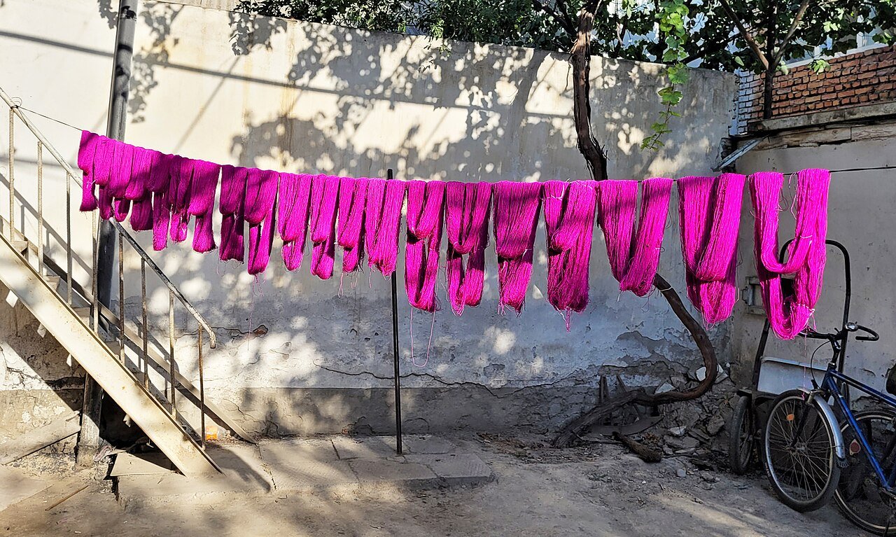
Ikat textiles are particularly instructive because the pattern depends on preparing and dyeing threads before weaving. A finished cloth therefore embodies a sequence of coordinated tasks. Its appearance cannot be explained solely by the person operating the loom. The organisation of work is part of the object, even when it is invisible to the buyer.
The Margilan Crafts Development Centre, established in 2007, illustrates a contemporary effort to support the transmission of skills. UNESCO's account of the centre describes its role in safeguarding atlas and adras production. This is a modern chapter in the life of a craft, not evidence that every current technique has remained unchanged since antiquity.
Ceramics offer a different relationship between materials and making. Clay preparation, forming, decoration and firing all influence the result. Workshop conversations can reveal how a maker balances inherited methods with new equipment or markets. The most useful question is often how the work has changed within living memory, rather than how many centuries of unbroken continuity can be claimed for a souvenir.
24. Women, embroidery and the household archive
Embroidered textiles make women's work more visible in a history often dominated by rulers, soldiers and scholars. Suzanis associated with settled communities in Uzbekistan and Tajikistan were used to furnish domestic interiors. A surviving textile records choices about colour, pattern, scale and workmanship, while also pointing towards the household for which it was made.
The Met's Bukhara-associated embroidered cover provides one example of how a museum interprets such an object. Its regional attribution is a starting point for comparison, not a rule that every textile from Bukhara looks identical. Individual makers, available materials and the intended function all matter.
The time involved in producing an embroidered furnishing is also historical evidence. Preparation, drawing and stitching required knowledge and labour, sometimes shared among several people. These activities can reveal relationships between generations and the transmission of skills that do not appear in official chronicles. Work performed within a household was still skilled economic and cultural activity.
Care is needed when attaching meanings to every motif. A seller's explanation of a flower, bird or circular design may represent one interpretation rather than a universally documented code. Compare the object with dated examples and listen to the maker's own account. Textiles become more informative when their uncertainty and individual history are preserved alongside their beauty.
25. Music, poetry and performance
Music is another way in which the country's past remains active. Shashmaqom is a classical vocal and instrumental tradition shared with Tajikistan, shaped within the urban culture of Central Asia. Poetry, melodic organisation and the skills of performers belong together in this repertoire. Listening to it introduces a historical inheritance that cannot be understood through architecture alone.
UNESCO's Shashmaqom description emphasises the importance of transmission between masters and students. Musical knowledge includes interpretation and performance practices that notation alone cannot fully preserve. A recording provides access to a performance, but it does not replace the relationships through which musicians learn.
The wider musical landscape is diverse. Regional traditions should not be merged into one supposedly uniform national sound, and a short performance arranged for visitors may present only a small selection. Ask which repertoire is being performed and what role the instruments play. Those questions give the event a setting beyond background entertainment.
Performance also changes with its audience. A court, a family celebration, a concert hall and a tourist venue create different expectations. Adaptation is part of cultural history, but so is the effort to maintain difficult repertories that require sustained training. Supporting knowledgeable performers and taking time to listen can make music as memorable a part of a journey as any monument.
26. Food, hospitality and the seasonal calendar
Food history begins with agriculture, work and access to ingredients. Markets brought the products of different environments together, while household practice turned them into meals suited to particular occasions. A dish associated with a city or region reflects those relationships, though its recipe may vary between families and change over time.
Palov has a prominent place in Uzbekistan's social life. Its preparation and sharing can accompany gatherings and important events, connecting cooking with the organisation of community relationships. UNESCO's Palov culture and tradition record recognises these practices, rather than defining one compulsory recipe or awarding ownership of all related rice dishes to a single country.
Seasonal celebrations offer another connection between everyday life and historical memory. Navruz marks the arrival of spring across a broad region beyond Uzbekistan. Its significance includes renewal, preparation and gathering. UNESCO's Navruz overview places the celebration within that wider shared geography.
Visitors can explore these histories through questions about occasions as well as ingredients. When is a particular food prepared? Who usually makes it, and how are guests served? The answers reveal social practice more effectively than an unsupported legend about a famous ruler inventing a dish. A contemporary meal is part of a continuing culture, not a surviving recipe sealed off from historical change.
27. Communities and the plural history of the cities
Uzbekistan's towns have been shaped by communities with different languages, occupations and religious affiliations. Bukharan Jewish history is one important part of that inheritance. The term refers to a wider Central Asian community, not only to people resident in the city of Bukhara. Its cultural connections include the Persian-speaking world and distinctive religious traditions.
Evidence for this history comes from documents, travellers' accounts, buildings and family memory. These sources have different limits. A traveller might record what appeared unusual while overlooking ordinary cooperation between neighbours. An official account may describe legal status without conveying the variety of personal relationships. Comparing sources helps avoid reducing centuries of life to one simple image of either harmony or conflict.
Encyclopaedia Iranica's history of Bukharan Jews discusses the community across successive periods. Its story includes exchange and cultural contribution as well as discrimination, restrictions and later migration. These experiences belong within the history of the cities, rather than appearing only as an optional aside.
The twentieth century added further layers through migration, evacuation and forced displacement. Present diversity has several historical origins, and different families remember those origins differently. Places of worship, cemeteries and community collections can help visitors encounter this history respectfully. They remain connected with living people and should not be approached solely as remnants of communities assumed to have vanished.
28. Karakalpakstan, Nukus and the preservation of art
Karakalpakstan adds a distinct regional perspective to the country's history. Its cultural heritage cannot be reduced to the disaster of the Aral Sea or treated as an extension of Khiva's monuments. The lower Amu Darya landscape contains archaeological sites, communities and artistic traditions with their own histories. Regional identity and the wider history of Uzbekistan belong together without being interchangeable.
In Nukus, the museum associated with Igor Savitsky makes this variety especially visible. Founded in 1966, it brings together Karakalpak applied arts, archaeological material and important collections of twentieth-century painting. Its development connects the study of local culture with the preservation of works that did not fit comfortably within dominant artistic expectations.
The museum's official history provides the institutional background. The significance of the collection is not only the fame of individual paintings. Displaying regional objects alongside modern art invites visitors to consider different ways in which a society records itself and different reasons why objects survive.
A museum is itself a historical creation. Collectors, curators, artists and public institutions make choices about what to preserve and how to explain it. A visit to Nukus therefore adds another question to the journey: who has shaped the version of the past now available to us? That question is relevant in every museum, including those devoted to the country's most familiar imperial and national narratives.
29. Where to experience Uzbekistan's history
Start in Tashkent for museum collections and the modern capital. Continue to Samarkand for Afrosiab, Timurid patronage and Ulugh Beg's scientific legacy, then Bukhara for early Islamic architecture and the institutions of a major oasis city. Khiva offers an especially concentrated encounter with the later khanate period inside Itchan Kala.
Different routes reveal different histories. Termez brings the Buddhist and Bactrian south into view. Shakhrisabz complements Samarkand's Timurid story. Kokand, Margilan, Andijan and the other Fergana Valley towns connect political history with crafts, migration and new urban foundations. The lower Amu Darya and Karakalpakstan add Khorezmian archaeology and the modern environmental history of the Aral Sea region.
At every stop, distinguish the age of a site, the date of a building and the age of its visible restoration. Use museums, inscriptions and local expertise together. The goal is not to find one unchanged past, but to understand how successive communities have inhabited and remade the landscape. Browse our 17 city histories of Uzbekistan for the next stage of the journey.
Sources and further reading
- UNESCO: History of Civilizations of Central Asia — a multi-volume regional framework spanning ancient to modern history.
- State Museum of the History of Uzbekistan: ancient statehood.
- UNESCO: Samarkand — Crossroad of Cultures.
- UNESCO: Itchan Kala.
- Encyclopaedia Iranica: Kokand Khanate.
- Encyclopaedia Iranica: Jadidism.
- Uzbekistan Ministry of Foreign Affairs: historical overview — an official national account, read alongside the scholarly and institutional sources above.
- United Nations: member states and admission dates.
This is a selective introduction for travellers, not an exhaustive political history. Dates before the modern period may describe different stages of a site's development; legends and commemorative traditions should be distinguished from independently established chronology.